“Vilcabamba – de jura fluminis et Terrae” VIDEO
Decolonial and sound countermapping of Mother Earth’s veins and arteries unveils the complexity of ecosystems, their intrinsic rights and struggles to uphold them.
“There are close and widely-noted links between colonial expansion and the development of the social sciences. Geography in particular appears as the science of European imperialism, with the creation of categories—“geography of exploration,” “colonial geography,” and “tropical geography”—which reflected a patriotic science, applied to colonized territories. Although this was made possible by the colonial context—maps are needed to conquer a territory, information is needed for the administration of populations—the development of geography reflects more complex realities.”
Marie De rugy , « Geography in the Colonial Contex », Encyclopédie d’histoire numérique de l’Europe [online], ISSN 2677-6588, published on 22/06/20, consulted on 01/07/2021. Permalink : https://ehne.fr/en/node/12346


Vilcabamba
De iura fluminis et Terrae
A chamber music piece in two acts


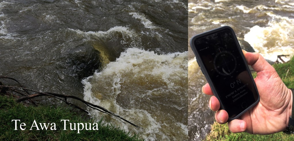
Act 1 . Te Awa Tupua
Whanganui river -35° 40′ 00″ S 174° 27′ 00″ E
Rio Vilcabamba -4° 14′ 46″ S -79° 17′ 54″ W
Ganges river 25° 32′ 15” N 83° 11′ 45” E
Magpie River 50° 19′ 00″ N -64° 27′ 00″ E
Rio Atrato 8° 15′ 19″ N -76° 58′ 47″ E
Rio Cauca 2° 35′ 26″ N -76° 46′ 44″ E
Rio Cocorà 4° 24′ 03″ N -75° 17′ 25″ W
Rio Coello 4° 18′ 00″ N -74° 54′ 00″ W
Rio Combeima 4° 19′ 18″ N -75° 08′ 50″ W
Rio La Plata 7° 33′ 00″ N -72° 47′ 00″ W
Rio Magdalena 7° 14′ 51″ N -73° 55′ 47″ W
Turāg River 23° 43′ 03″ N 90° 21′ 34″ E
Yamuna River 25° 25′ 26″ N 81° 53′ 07″ E
Klamath River N 41° 52′ 12.396″, W 122° 43′ 14.8872″
Wekiwa River 28° 51′ 20.25″ N -81° 23′ 2.35″ W
Econlockhatchee river 28° 40′ 23.99″ N -81° 06′ 30.00″ W
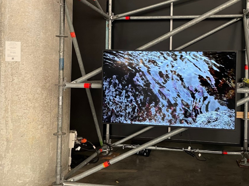
Intermezzo: Cuencas Sagradas
Rio Napo: 2°00′50″S 74°20′27″ O
Rio Pastaza 1°24′18″S 78°28′21″O
Río Marañón 10°18′36″S 76°39′19″O
Act 2: PACHAMAMA
Gulf of Mexico 25.681137, -89.890137.
Lago Agrio 0° 4’ 00” N -77° 00’ 00”
ITT Yasuni 0° 46′S 76°06′O
Condor Mirador 4°00′S 78°30′
Bagua 5°38′00″S 78°32′00″ O
Belo Monte 3º7’34,7” W S; 51º45’52,8” N
Conga Cajamarca · 6°56′13″S 78°22′05 ″O
ríos Pastaza, -4° 55’ 00” S -76° 24’ 00” W
Rio Corrientes, -3° 46’ 11” S -74° 29’ 05” W
Río Tigre 4°29′07″S 74°03′59″O
Tapajos river 2°24′34″S 54°42′56″O
Almeria O2°27’35.06” N36°50’17.3
Sarayaku -1° 44’ 11” S -77° 29’ 05” W
Hambach Forest 50° 07’ 00” N 10° 49’ 00” E
Montagne D’Or 4.7155°N 53.9398°W
TIPNIS 15°27′00″S 66°40′00″O
Chiquitania 18° 00′ 0.00″ S -60° 00′ 0.00″ W
Vaca Muerta -29° 56’ 00” S -69° 19’ 00” W
Aysén 45°34′S 72°04′W
Pitipalena-Añihue 43°54′46′′S 73°2′16′′W
Santuario de la Naturaleza de Quitralco 45°48′01″S 73°29′35″O
Atacama O69°15’0″ S24°30’0″
Maroni river 5°45′14″N 53°57′44″O
Vättern Lake 58°24′N 14°36′E
Mer de Glace: 45°54′58″N 6°56′14″E
Marseille 43°17′51″N 5°22′38″E
Kopaonic-Jošanica 43°16′09″N 20°49′21″E
Great Barrier Reef 18° 9′ 22.6440” S , 147° 29′ 9.4632” E
